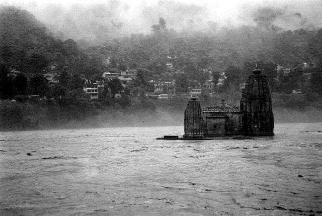
As power and mobile connectivity gets restored in Himachal Pradesh following the deluge on July 9 to July 11, the true extent of the devastation caused by the flash floods to the mountain state is becoming apparent. Social media is awash with videos of roads, bridges, cars, trucks, busses and building being swept aways by the raging waters in the rivers. With more rain forecast by the India Meteorological Department (IMD) for rest of the month, it seems, the gateway to the Western and Greater Himalaya will be bearing the fury of the Indian Summer Monsoon like never before.
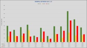
Between July 1-17, the state received excess rainfall ranging from 81.9 mm (Lahaul & Spiti) to 531.8 mm (Sirmaur). The Kullu Valley, which suffered largescale destruction of roads and bridges received 260.4 mm excess rain in the first 17 days of July.
The heavy downpour across the state triggered flash floods in most of the rivers and streams draining from the glaciers in the higher reaches of the mountain state. According to IMD data, Himachal received 233 mm of rain between July 7 and July 10 compared to the normal average of 41.6 mm. The long-term average rainfall for Himachal during the monsoon season is 734 mm, of which it received almost 31% in just four days. Environmental experts point that such extreme weather events are evidence of climate change.