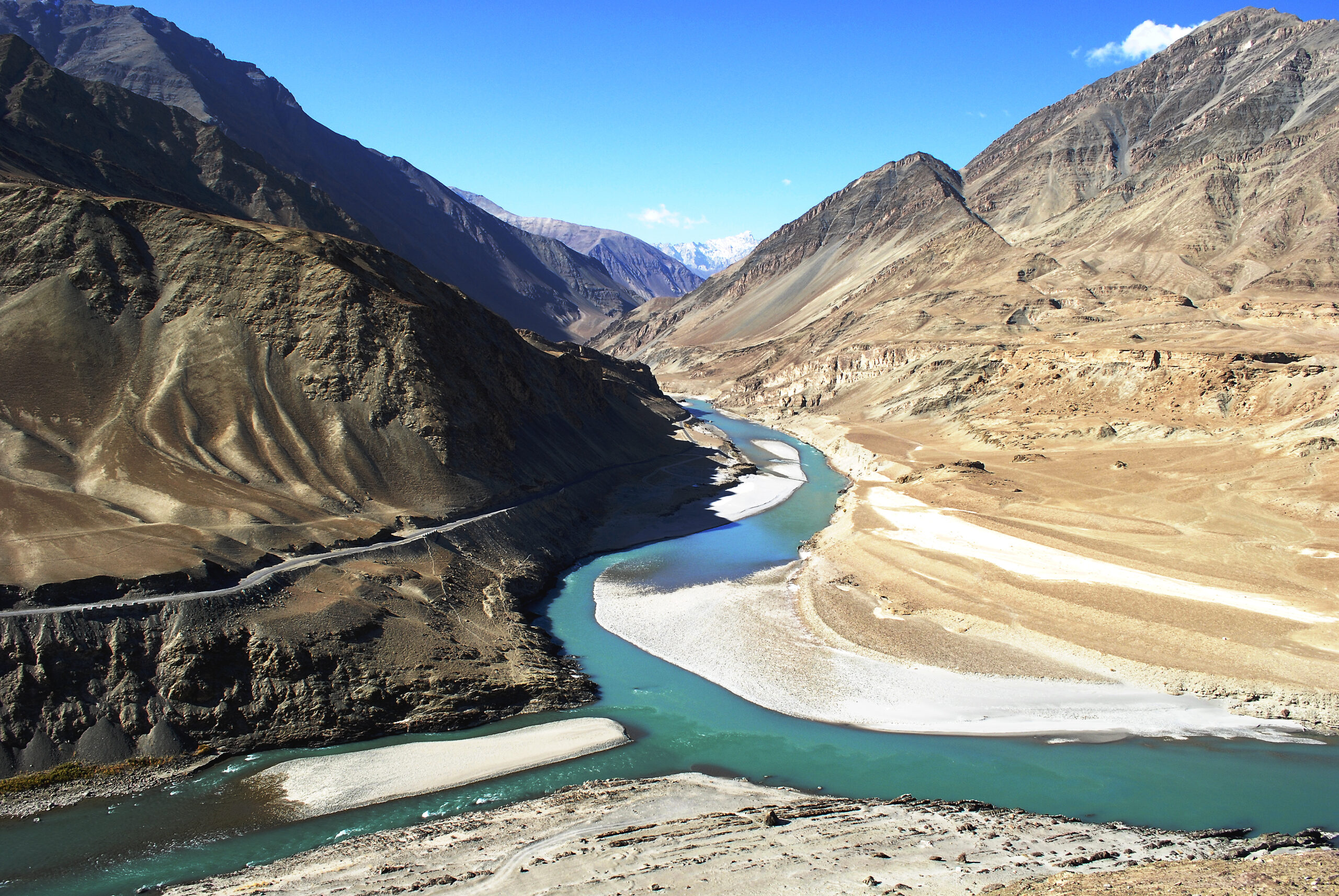
Secrets hidden in ancient lake sediments deposits recovered from the Indus River valley in Ladakh have helped retrace the climate since last deglaciation from 19,600 to 6100 years, paving the path towards understanding climate variation during the era.
Researchers have reconstructed millennial to centennial-scale climate records from the paleolake deposits and identified a cold arid period, followed by strong monsoon period and subsequent weakening monsoon phase with enhanced El Nino activities with climate variations in the Last Glacial Maxima.
Ladakh region in the Trans-Himalaya forms an environmental boundary between North Atlantic and monsoon forcings. Its location is ideal to gain insight into the variations of the atmospheric circulations like westerly and Indian summer monsoon. A comprehensive understanding in the variability of these atmospheric circulations is essential, particularly in the wake of global warming. Besides plethora of sedimentary archives exist in the region that can be used to extract past climate information. Among them, the sediment deposits in lakes, due to their continuous sedimentation rate, are useful in attesting both short and long-term climatic changes. Therefore many studies from the Ladakh region have been attempted from lacustrine sequences to provide information about climate change. However, most of these studies are focused only in the Holocene period (around last 10 thousand years), and older periods are less addressed.
Noticing the presence of numerous ancient lake deposits all along the Indus River that were easy to identify, continuous, and accessible, Scientists from Birbal Sahni Institute of Palaeosciences (BSIP), an autonomous institute of Department of Science and Technology, sampled sediments from 18 m thick sediment sequence at an altitude of 3,287 m and carried out meticulous laboratory analysis of the samples. They used physical characteristics like colour texture, grain size, grain composition, total organic carbon, and magnetic parameters of sediments to extract past climate information from the palaeolake sedimentary archive. This was used to reconstruct palaeoclimate variations of the period.
The researchers found that cold arid climate influenced by westerly circulation reigned for the last 19.6 to 11.1 ka (thousand years). Thereafter from 11.1 to 7.5 ka, monsoon forcings dominated the climate of the region, following which the orbitally controlled solar insolation took over, influencing the position of Inter Tropical Convergence Zone ITCZ and was the key driver of the variability of these atmospheric circulations. A short wet phase from around 17.4 to 16.5 ka within the dominant westerly period is attributed to the early wet phase of a two-fold H1 event called. Westerlies regained strength from 7.5 to 6.1 ka during the mid-Holocene, coinciding with decreasing insolation, weakening monsoon, and enhanced El Nino activities.
Large-scale climate reorganization occurs during the shift from glacial to interglacial climate. This makes the glacial-to-interglacial transitional time period essential for understanding of climate evolution. In particular, mountain regions are more vulnerable to these changes owing to their geomorphological set-up. Therefore it is pertinent to have a clear and better understanding of how the hydroclimate of a region is changing as climate shifts from an overall colder to an overall warmer condition.
The study published in the journal PALAEO3 can help gain insights into the past climate variations since the last deglaciation that followed the Last Glacial Maxima and recognize the influence of different forcing mechanisms and teleconnections to improve the understanding of climate variability during the dynamic transitional phase as well as the evolution of ISM and Westerlies in the transition phase during the deglaciation time period.