 Dr. Bhashyam Kasturi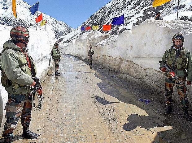
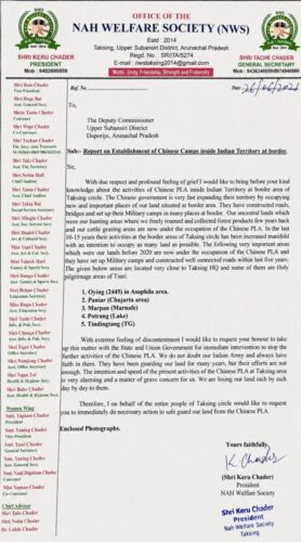 At the end of June 2026, a tribal organization in Arunachal Pradesh alleged that China’s Peoples Liberation Army (PLA) had encroached into Indian territory in the Taksing region of Upper Subansiri District in Arunachal Pradesh. The Nah Welfare Society (NWS) in a memorandum addressed to the Deputy Commissioner of the District has claimed that China had built roads, bridges and other military infrastructure in their traditional grazing lands. While the Indian Army denied the allegations immediately, the State Government was a little more cautious and stated that an inquiry would be initiated to ascertain the veracity of the allegations made by the NWS. However, subsequently on 27th July, Arunachal Pradesh Home Minister Mama Natung flatly denied the allegations. The tribal organization has listed five places where the incursions by the PLA have taken place, but it is not clear whether the incursions are south of the Line of Actual Control (LAC) or not.
NWS Claims Chinese Presence at Five Border Locations
The challenge raised by NWS is not that the PLA has carried out incursions along the border with India. The latest allegations reinforce the recent trend of the PLA trying to pressurize Indian forces all along the LAC, starting from Ladakh to Arunachal Pradesh.
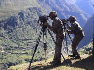
The PLA is not acting in isolation becomes clear from the incursions in five different places in Upper Subansiri District. The places mentioned are Oying (site 2445) in Asaphila, Paniar in Churjata area, Marpan (Marnafe), Portrang (Lake) and Tingdingtang. A similar thing happened post the 2020 Galwan clash when Ladakhi herders claimed that traditional grazing grounds had become off limits because the Chinese had moved in.
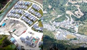
The memorandum is signed by Keru Chader, President NWS, and encloses pictures taken on the ground. The memo states that the occupied areas are very close to the Taksing area adding that some are close to the Tsari holy pilgrimage areas.
The NWS memorandum only speaks of their grazing lands being occupied by the PLA. There is nothing to inform whether these areas are south or north of the LAC/McMahon line, making it difficult to substantiate or negate the claim made by the NWS. Still, the fact that NWS claims that this land grabbing has been going on for the last 10-15 years merits attention and merely denying the claim does not bode well for India’s security.
The Challenge Persists in Eastern Ladakh
Two things are of note here.
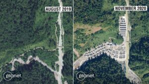
The latest incursions are not temporary in nature, rather these are Chinese efforts to establish a permanent presence close to the LAC. This is being done by construction of Xiaokong villages, more military outposts, feeder roads close to the LAC and enhanced military exercises. Chinese tactics have in fact made 26 out of 65 Patrolling Points (PP) inaccessible to India, according to P.D. Nitya, then SP, Leh.
The issue of greater concern is that of the 628 Xiaokong villages, China has built 72% across the LAC in the north-east, with 90% of these being opposite Arunachal Pradesh. This information was given by none other than Lt. Gen. Rajiv Ghai, on 10th March 2026, during a USI-Assam Rifles annual seminar.
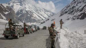
At the opposite end of the frontier, in eastern Ladakh, the aftermath of the 2020 clashes in Galwan, Pangong Tso and the Gogra region reshaped the military landscape. To reduce the risk of another sudden confrontation, India and China established buffer zones across several friction points, creating physical separation between their forward-deployed forces. This, of course, has resulted in traditional grazing grounds becoming unavailable for herders from Ladakh. The nomadic Changpa community has in fact stated that Chinese PLA soldiers dissuade them from going near PP 35 and 36.
In July 2026, a 15-member delegation from Ladakh met and briefed the Parliamentary Standing Committee on Tourism, Transport and Culture that their presence in these regions contributed to national security. The locals claimed that they had lost their grazing lands since the clashes in 2020. Konchak Stanzin, councillor in the Chushul area had made similar claims in 2024.
Differing Perceptions of the LAC
This is because there are differing perceptions of where the LAC lies between India and China. This un-demarcated border makes it difficult to pin down locations. The 1914 McMahon Line was a line drawn on the map between India and Tibet, but during the 1960 discussions on the Boundary Question, India did argue that the alignment of the McMahon Line in the eastern sector, represented the traditional and customary border between India and Tibet. Subsequently, in 1979, according to Ambassador C.V. Ranganathan, both sides had agreed that the ‘notional LAC’ would be maintained and peace and tranquillity would be kept.
The challenge today is that the Line of Actual Control, once a largely notional boundary, has become an increasingly volatile frontier. Since 2020, China has almost continuously and steadily sought to alter the status quo through incremental territorial encroachments and has engaged in nibbling away at Indian territory —a strategy often described as “salami slicing.”
So long as India and China continue to operate with competing perceptions of where the Line of Actual Control lies, the border will remain a persistent source of friction and periodic military tensions.