 Dr. Bhashyam Kasturi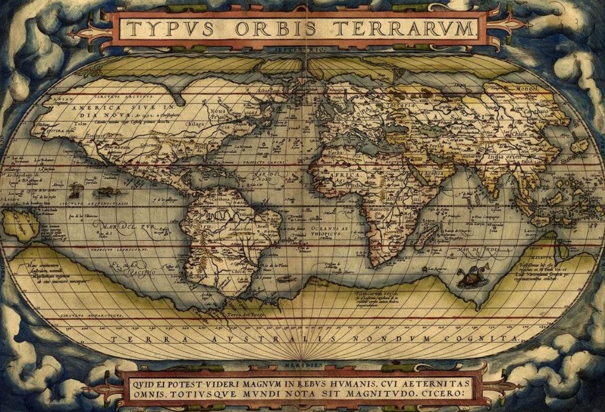
The United Nations General Assembly on 4 September 2026, adopted among other things, the text of a resolution ‘to correct the map’. Notably, India was one of the 164 nations, who voted in favour of the resolution and yet soon thereafter had to register a protest, against the UN’s depiction of Aksai Chin and Arunachal Pradesh as disputed territories.
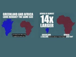
Only one country, the US, rejected the resolution and six nations abstained from voting. According to the official UN record, the draft resolution titled “Correct the Map: rebalancing global cartographic representation and promoting equitable representation of the world’s regions, particularly Africa”, calls for wider use of equal-area map projections, particularly the Equal Earth projection, in the context where the comparative size of continents matter.
The objective of this exercise, according to the UN, is to frame the issue as more than a technical cartographic problem.
Equal-Areas Map vs the Mercator Map
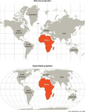
The attempt to create a map showing equal areas for all continents as opposed to the Mercator Map was first privately initiated in 2018. It was first adopted for use by NASA’s Goddard Space Centre. NASA used this map to display global temperature anomaly data, because a global data map needs to show the correct surface area of the Earth without heavily distorting the polar regions or the equator.
The push for an alternative to the Mercator map, in use since the 16th century, stems from a striking distortion: on the familiar projection, Africa appears roughly comparable in size to Greenland, despite being about 14 times larger in reality. What may seem like a quirk of cartography has long shaped the way generations have visualised the relative size—and significance—of the world’s continents.
Therefore, the principle behind the equal area map cannot be faulted and is probably why India chose to go along with the resolution. However, soon after passage of the resolution, the Ministry of External Affairs had to issue a strong statement. Notably, Japan and Ukraine also did the same.
India Voted for Resolution but rejected the map itself
The MEA, in its press release dated September 5, 2026, noted that India had during the voting for the resolution itself “made an explanation of vote stressing on the underlying principle of promoting equal-area cartographic representation.” At that time, India also highlighted that the resolution did not constitute endorsement of any specific map, projection or depiction of national boundaries. The operative part of India’s statement is that “India’s sovereign territory, including the Union Territories of Jammu and Kashmir and Ladakh, must be depicted in accordance with India’s official map. Any inaccurate or misleading depiction is unacceptable. Our position on India’s sovereignty and territorial integrity is clear, consistent and non-negotiable.”
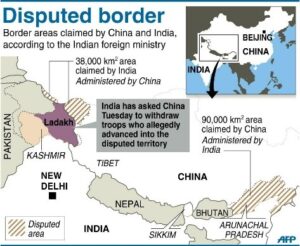
The Independent newspaper reports two discrepancies in the India map issued by the UN. First, it shows Aksai Chin in Ladakh as disputed and second, it shows the State of Arunachal Pradesh as also being disputed. What must have happened is that the UN map must have depicted the claim lines of both India and China, in the case of Aksai Chin and Arunachal Pradesh. Pertinently, India is not the only one to object; Japan also registered its protests because the map showed the Kurile islands as belonging to Russia. Ukraine, which abstained from the vote, said that Crimea was coloured in a lighter shade than that used for Ukraine.
China unequivocally supports the new Map
Recall that when the UN geospatial unit published its official world map on 1 July 2026, it showed Arunachal Pradesh and Aksai Chin as disputed territories, i.e., they showed the respective claim lines of India and China. The same was the case with the Kurile Islands and Japan. The China link to the new map is demonstrated in their vocal support. Writing in China Military Online, Li Haidong, termed the Mercator Map as one that emerged from a “Western-dominated international narrative system” and stated that equal areas map “reflects significant shifts in the international balance of power.” By supporting the African Union in its quest for a more equitable map, China is also trying to claim its place as a leader by speaking of the rise of the Global South being reflected in the adoption of the new UN map. China, thus, wholeheartedly supported the Resolution, knowing fully well that it serves its interests.
The Road Ahead
As the resolution is non-binding, individual countries do not need to follow the UN map. However, if the objective of the map was merely to show the actual size of continents, then why it did introduce disputed claim lines in several instances? The answer appears to lie in the UN statement that the map was being introduced to “frame the issue as more than a technical cartographic problem.” This suggests a conscious decision to introduce disputed claims even though that was not the primary objective with which Togo and the African Union had sponsored the draft resolution. That is why the Ukrainian remark on the map is relevant and important. It states that the map could be open to “abuse and distortion” and adds that it would be foolhardy to create a new problem while trying to settle an older one.
Thus, countries like India will face the challenge as other countries and their institutions switch to the equal-area world maps, as Togo already intends to do, then what will India do?